
The ISIS provides the following information:
Correct!
Wrong!
When radio nav back up modes are activated on RMP 1 and RMP 2, if selecting VOR on RMP 2 only:
Correct!
Wrong!
During an ILS approach, the ILS message is flashing amber in the lower right part of the PFD :
Correct!
Wrong!
In case of both FMGEC failure, ILS may be selected:
Correct!
Wrong!
How a manually selected VOR is displayed on NDs?
Correct!
Wrong!
Which hereafter statement is true about GPWS warnings?
Correct!
Wrong!
The BUSS (BackUp Speed Scale) is displayed on both PFDs when the flight crew turn off all ADRs.
Correct!
Wrong!
The amber ON BAT alert is displayed. What does it mean?

Correct!
Wrong!
When the aircraft is on ground and if at least one ADIRU is supplied by aircraft batteries: an external horn sounds and the ADIRU light comes on amber on the SERVICE INTERPHONE BAY panel.
ADR 1 sends aerodynamic informations to captain instruments and ADR 2 to F/O instruments. In case of failure of one of them:
Correct!
Wrong!
Pushing the GPWS - G/S p/b on ground will:
Correct!
Wrong!
Advertisement
The BackUp Speed Scale (BUSS) enables to fly the aircraft when airspeed indications are unreliable. When the BUSS is activated:
Correct!
Wrong!
Each ADIRU is divided in two parts:
Correct!
Wrong!
This memo appears in amber:

Correct!
Wrong!
The auto call out voice is generated by:
Correct!
Wrong!
If the IR 1 FAULT is lighted steady on ADIRS panel:
Correct!
Wrong!
The activation of this BUSS (BackUp Speed Scale) is reversible in flight when altitude is less than 25,000 ft.
Correct!
Wrong!
The activation of this BUSS is NOT reversible.
There are ____ identical ADIRUs (Air Data and Inertial Reference Units). Each ADIRU is divided in two parts, either of which can work separately in case of failure in the other
Correct!
Wrong!
During normal operations, heading information that is displayed on DDRMI is coming from:
Correct!
Wrong!
Inertial data (TK/GS, PPOS, WIND, HDG) are available if ADIRS selector is on:
Correct!
Wrong!
When radio nav back up modes are activated on RMP 1 and RMP 2, if selecting ILS frequency on RMP 2 only:
Correct!
Wrong!
Advertisement
The BUSS (BackUp Speed Scale) information is based on:
Correct!
Wrong!
In case of RA (Radio altimeter) 1 failure:
Correct!
Wrong!
If one RA fails, both PFDs display the height from the remaining RA.
GPS operations - During normal operations:
Correct!
Wrong!
GNSS, LOC and G/S antennas provide navigation data to MMRs (Multi-Mode Receivers).
Correct!
Wrong!
This memo appears in green:

Correct!
Wrong!
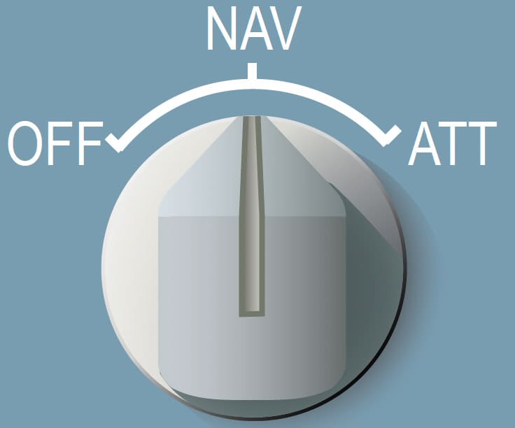
If the IR 1(2)(3) operates in ATT mode, IR 1(2)(3) only provides attitude and heading data (if entered by the flight crew). The navigation data are not available. The heading must be entered through the MCDU and has to be reset every _____
Correct!
Wrong!
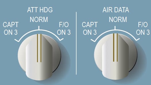
In this configuration (ATT HDG = NORM and AIR DATA = NORM):
Correct!
Wrong!
The ADIRU 3 receives information from:
Correct!
Wrong!
In ELEC EMER CONFIG, which informations are still displayed on DDRMI?
Correct!
Wrong!
The ADR (Air Data Reference) supplies _____
Correct!
Wrong!
Advertisement
The ON BAT light does not come on in the case of a fast alignment.
Correct!
Wrong!
ADIRU 3 includes:
Correct!
Wrong!
If the IR 1 FAULT light is flashing on ADIRS panel:
Correct!
Wrong!
During the flight, if the IR mode selector is set from NAV to ATT or NAV to OFF, the NAV mode is lost for the remainder of the flight.
Correct!
Wrong!
In normal operation, the NAVAIDS are tuned:
Correct!
Wrong!
The information produced by the ADIRU:
Correct!
Wrong!
IR 1 sends inertial informations at captain instruments and IR 2 at F/O instruments. In case of failure of one of them :
Correct!
Wrong!
In BACKUP ALTITUDE SCALE mode, the vertical speed indication is no longer displayed.
Correct!
Wrong!
When in ATT mode, the flight crew can only recover the NAV mode on ground:
Correct!
Wrong!
At high latitudes, North of 73 ° North, between 90 ° West and 120 ° West (magnetic polar region), and North of 82 ° North, and South of 60 ° South.
Correct!
Wrong!
In addition, the GRID track appears on ND.